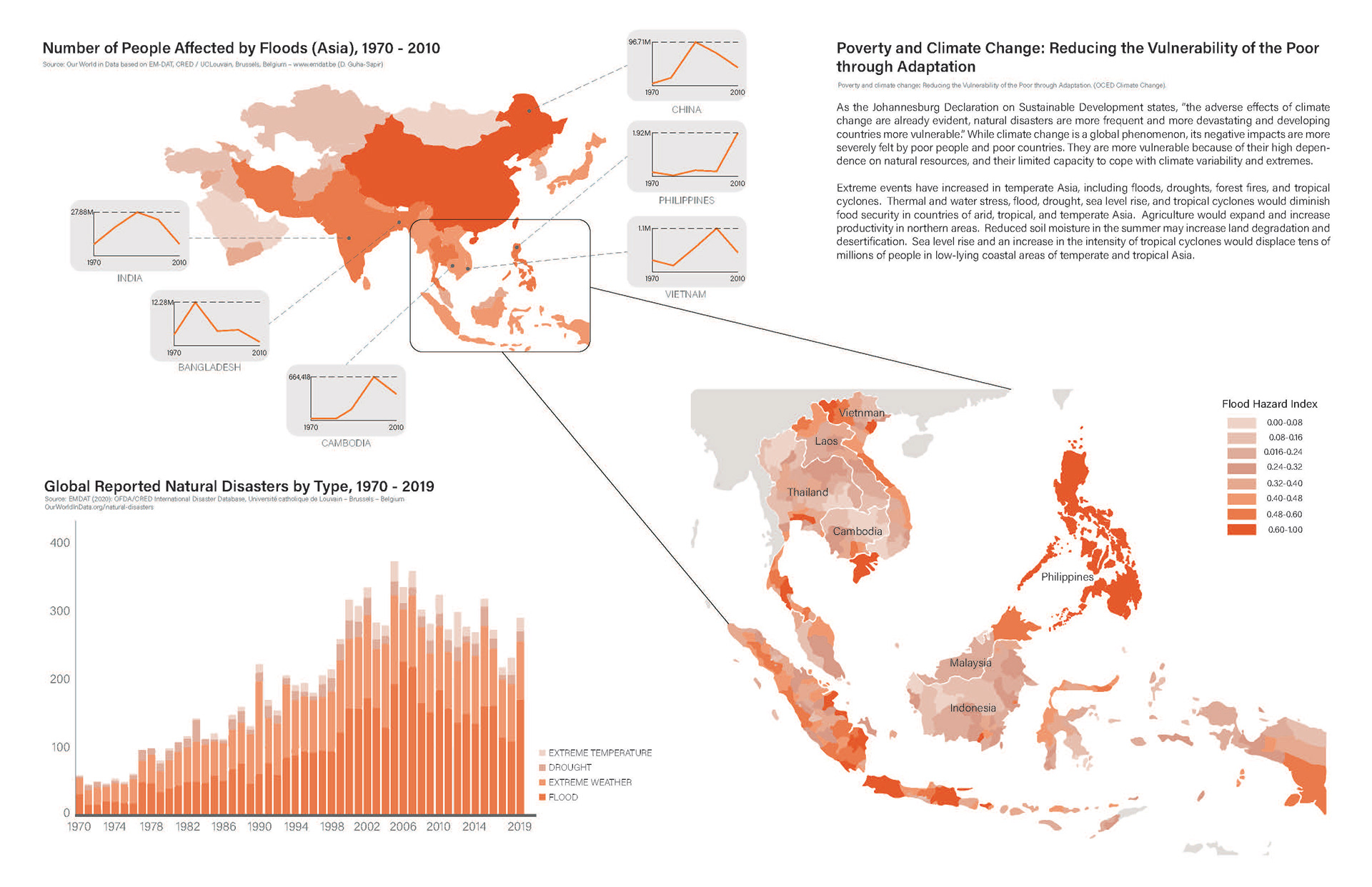
In the face of escalating climate and environmental changes, the repercussions of flooding and sea level rise on human populations have become an urgent concern. Rather than focusing on developed countries, we target less-developed regions where resources are limited to cope and survive such disasters.
Our thesis aims to decrease the potential flooding damage to the informal settlement families while improving their living conditions under the existing urban structure and high population density in the Baseco Compound in Philippines Manila. To achieve this, we began with reconstructing local churches and introducing a bridge system, while sticking to a realistic approach that considers the limited budget and resources of local communities. This project will assist local families in evacuating or accessing safer spaces faster before or during floods and improve the life quality of the local families, reframing the existing landscape of the site.
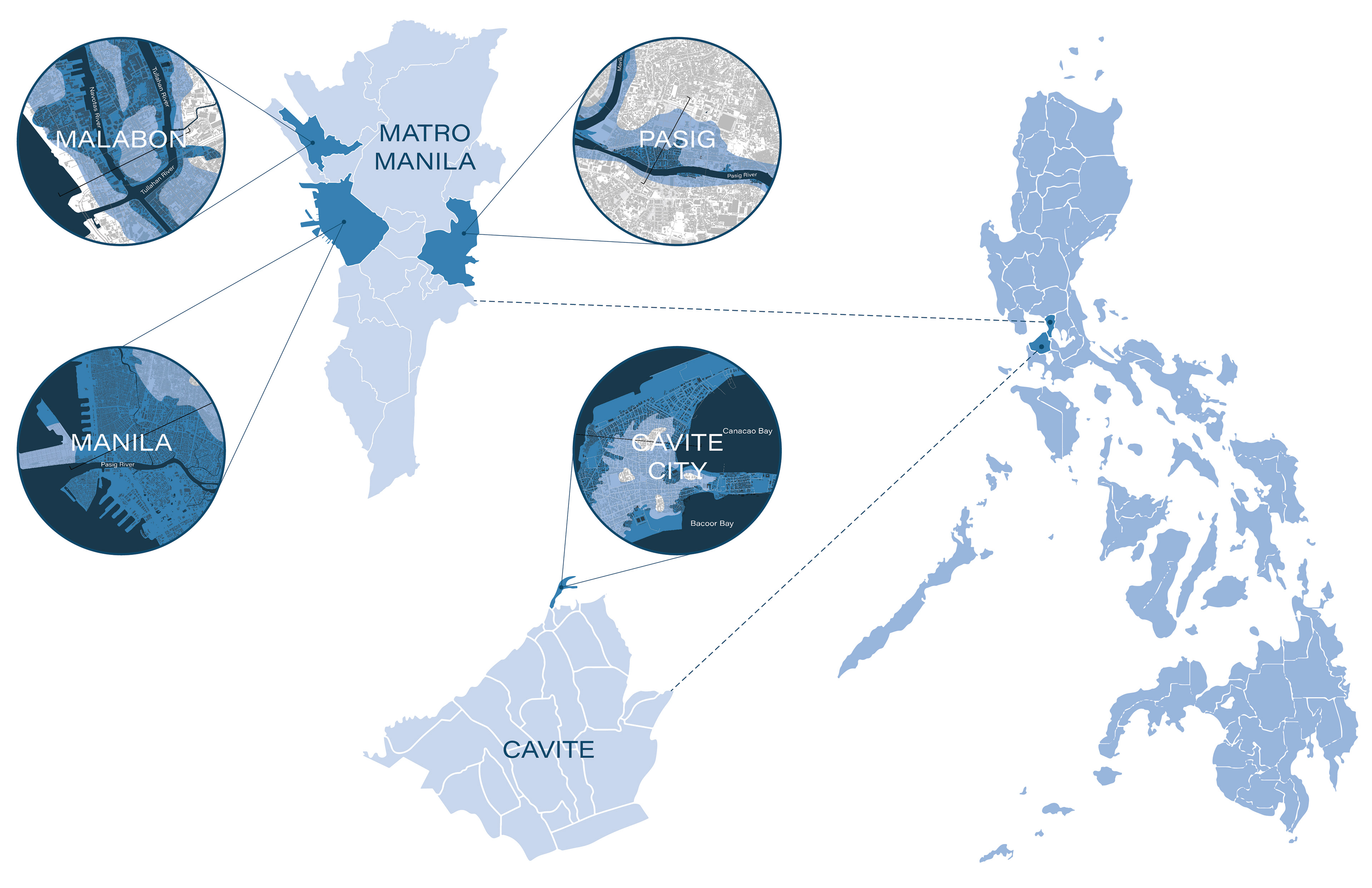
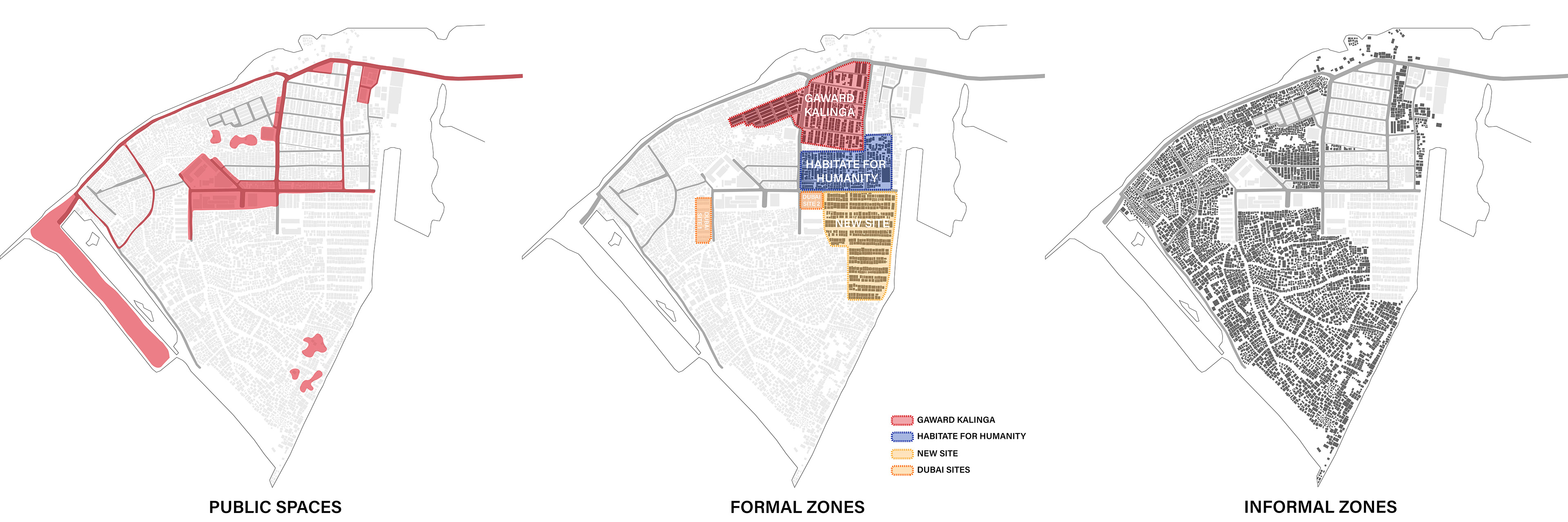
We target the BASECO compound, located in metro Manila, Philippines, due to its limited resources economically and politically. It is a reclamation delta with a total area of 53 hectares in the Metro-Manila Bay area. Because of the vulnerability to frequent floods, the density of the informal settlers, the limited spaces for the public, and the rooted social-economical condition, it is a miniature of the current world-wise situation under such climate disasters.
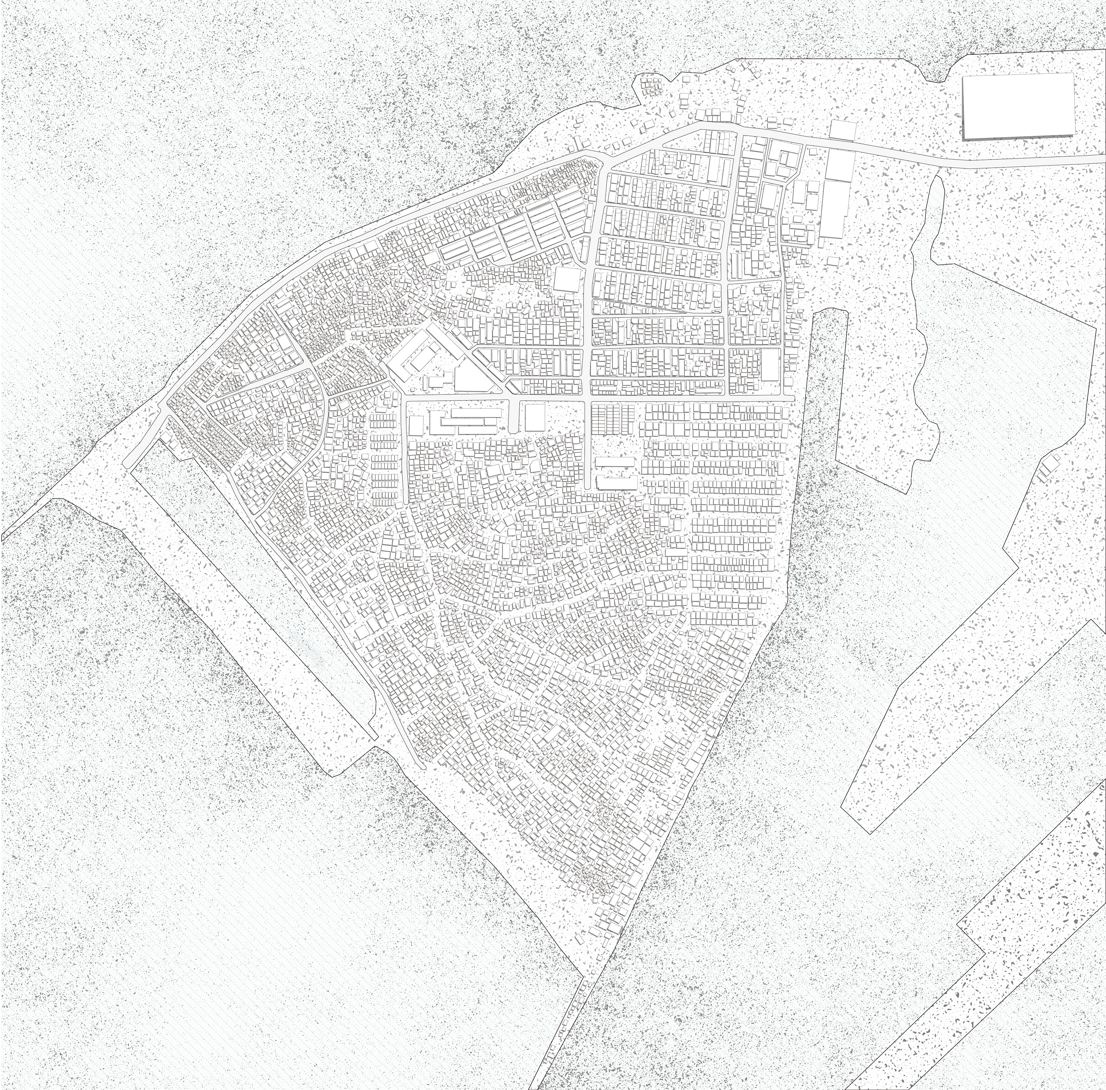
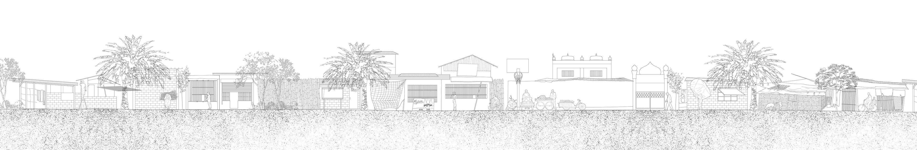
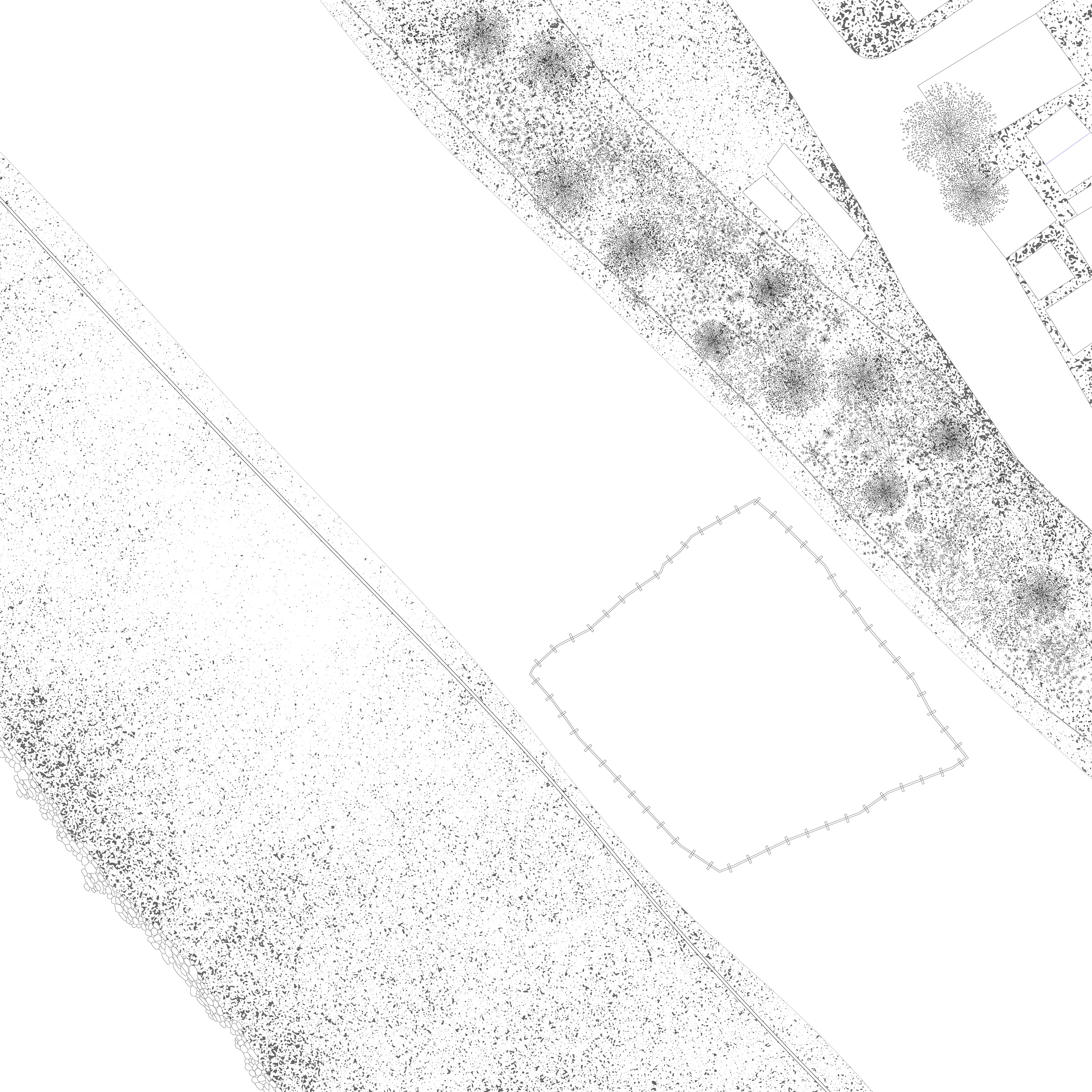
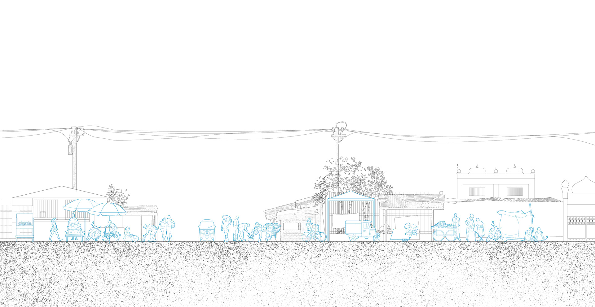
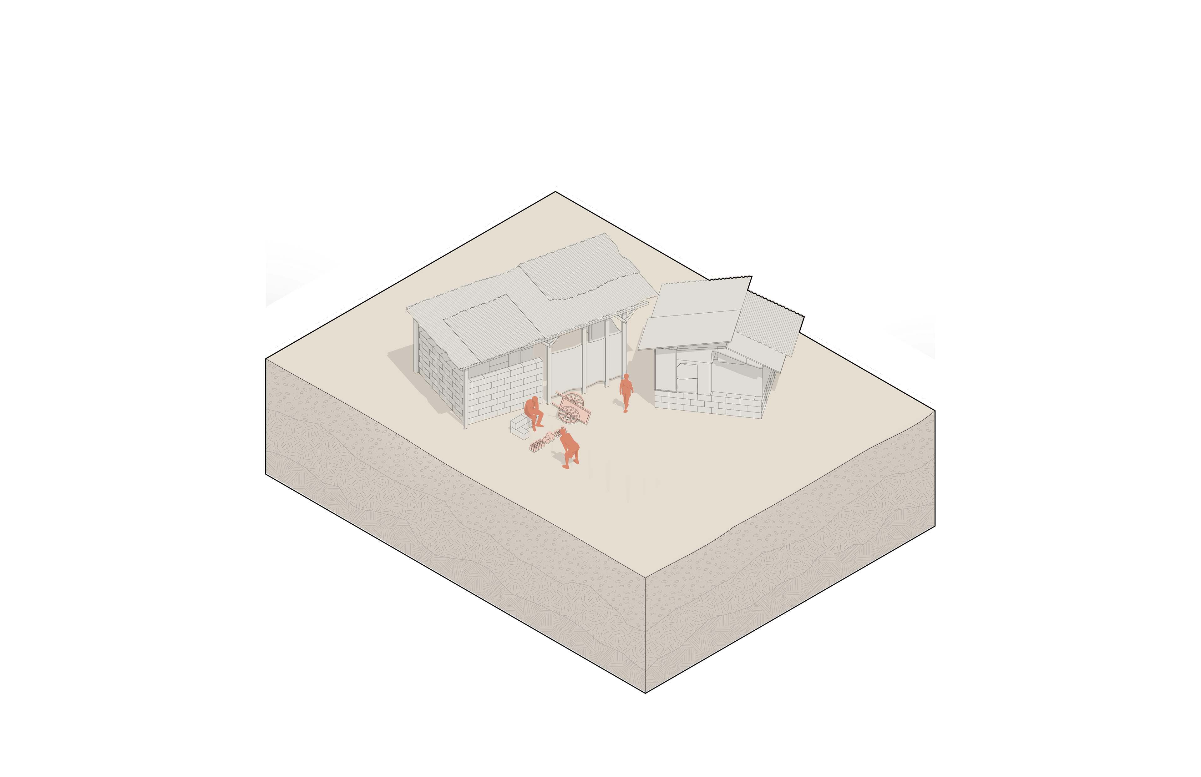
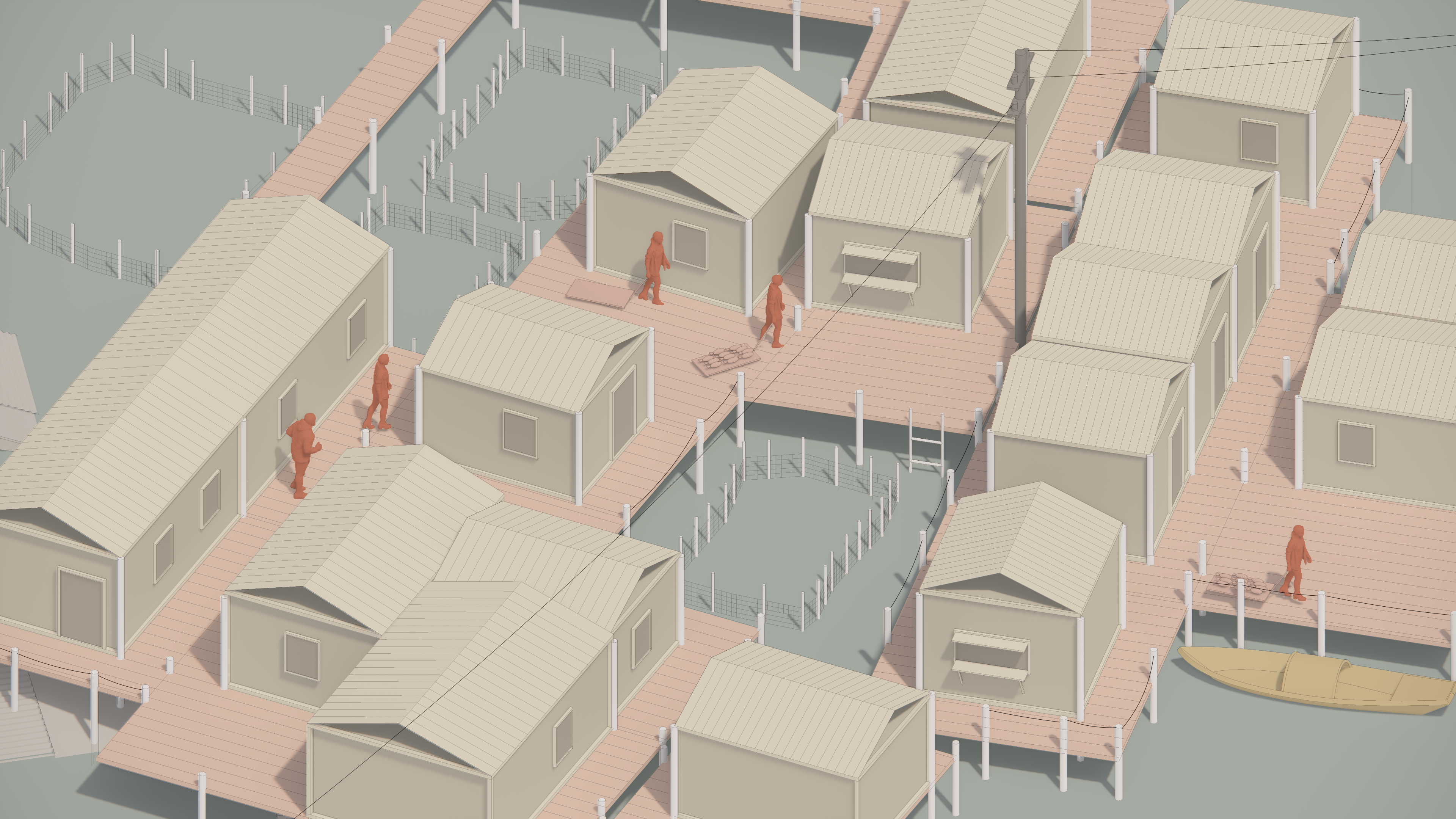
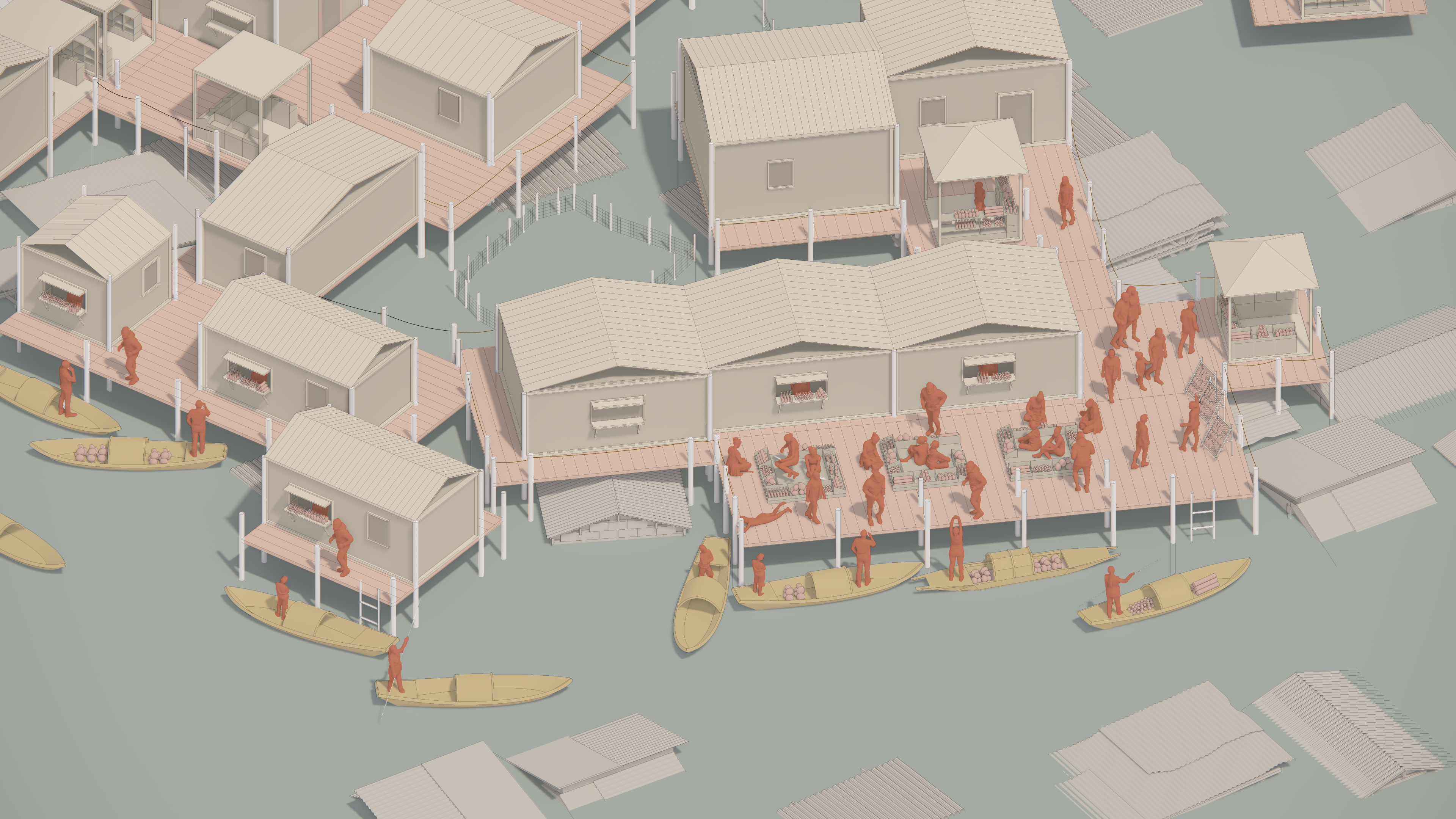
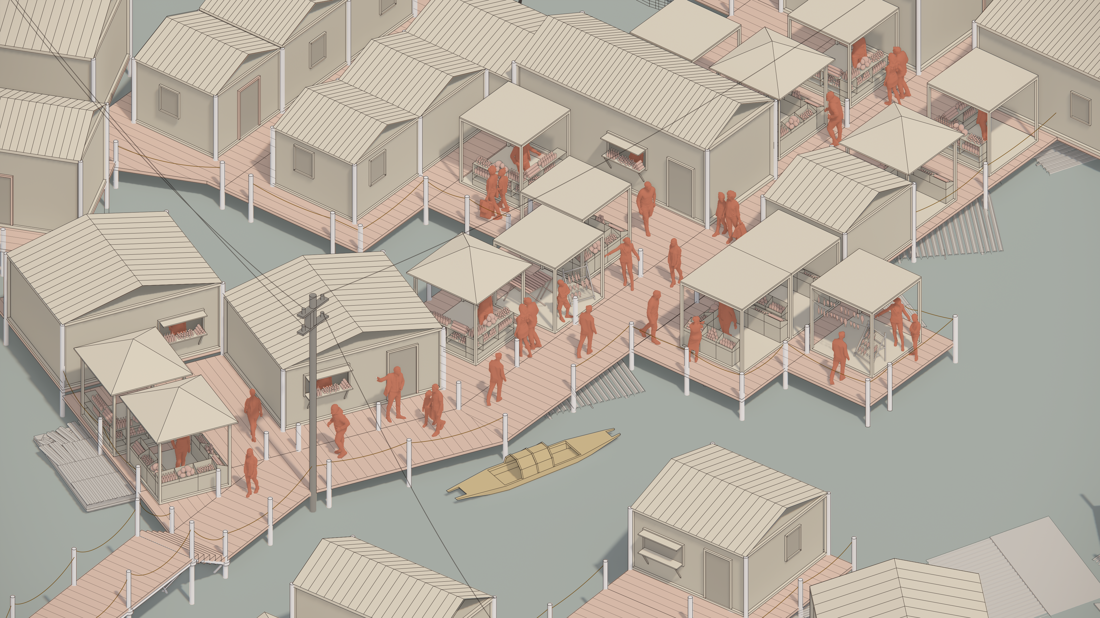
We look closer at some typical areas in BASECO with our methodology of drawing detailed plans and elevations that reveal the spatial relationship between the local buildings, outdoor spaces, and materiality, as well as programs that could be beneficial during the flood. The drawings also reflect the cultural and habitual relationships of the local residents. For example, people closer to the streets build temporary stalls to sell goods, and people near the pond might take it as a fish farm. The street and beach are part of their reactional life.
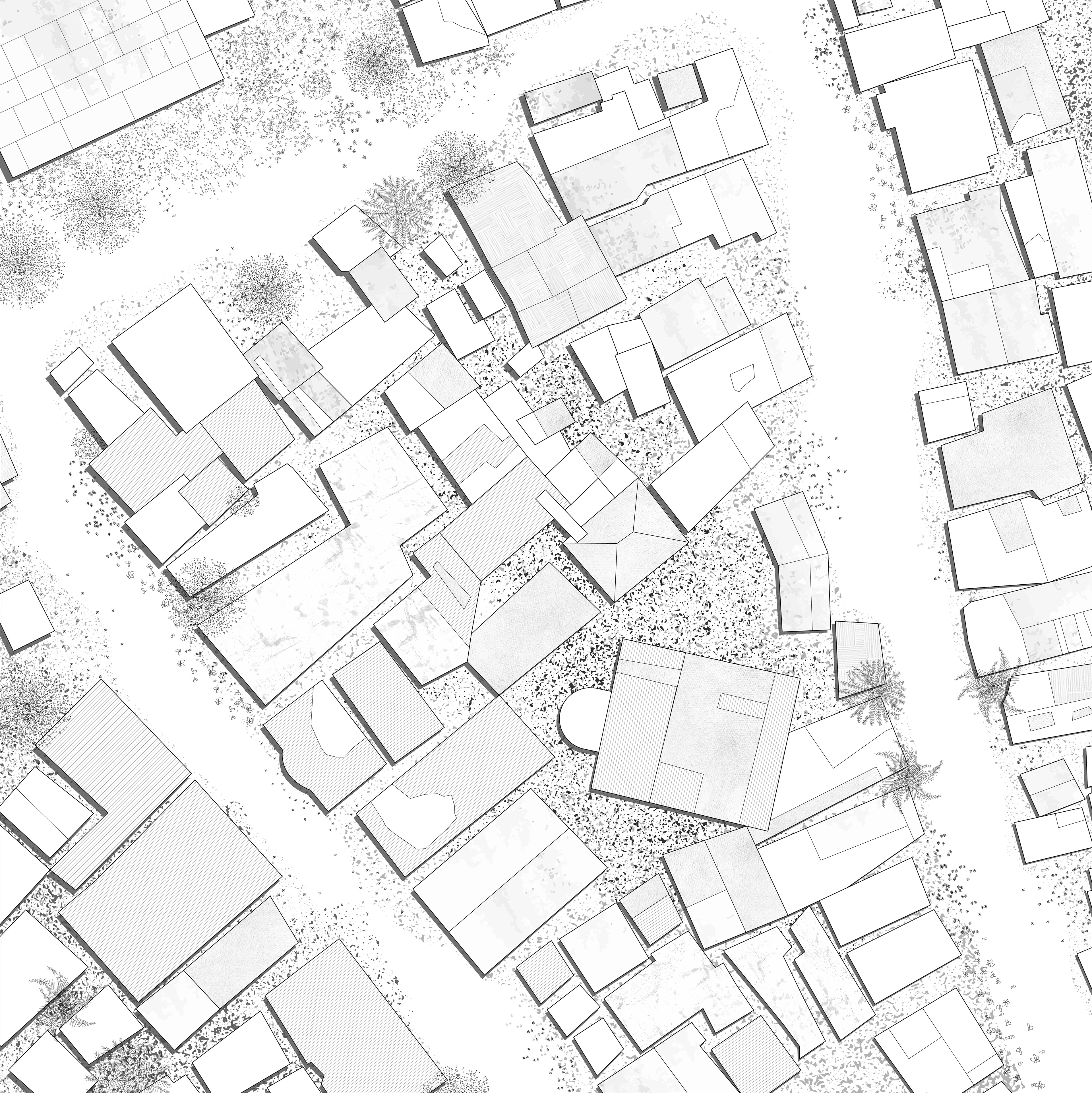


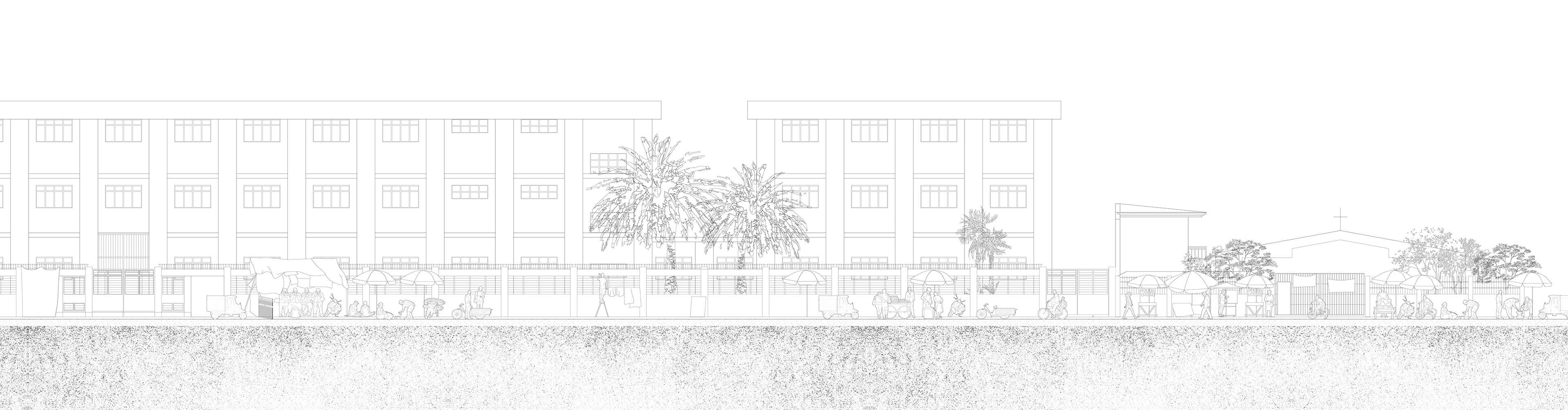
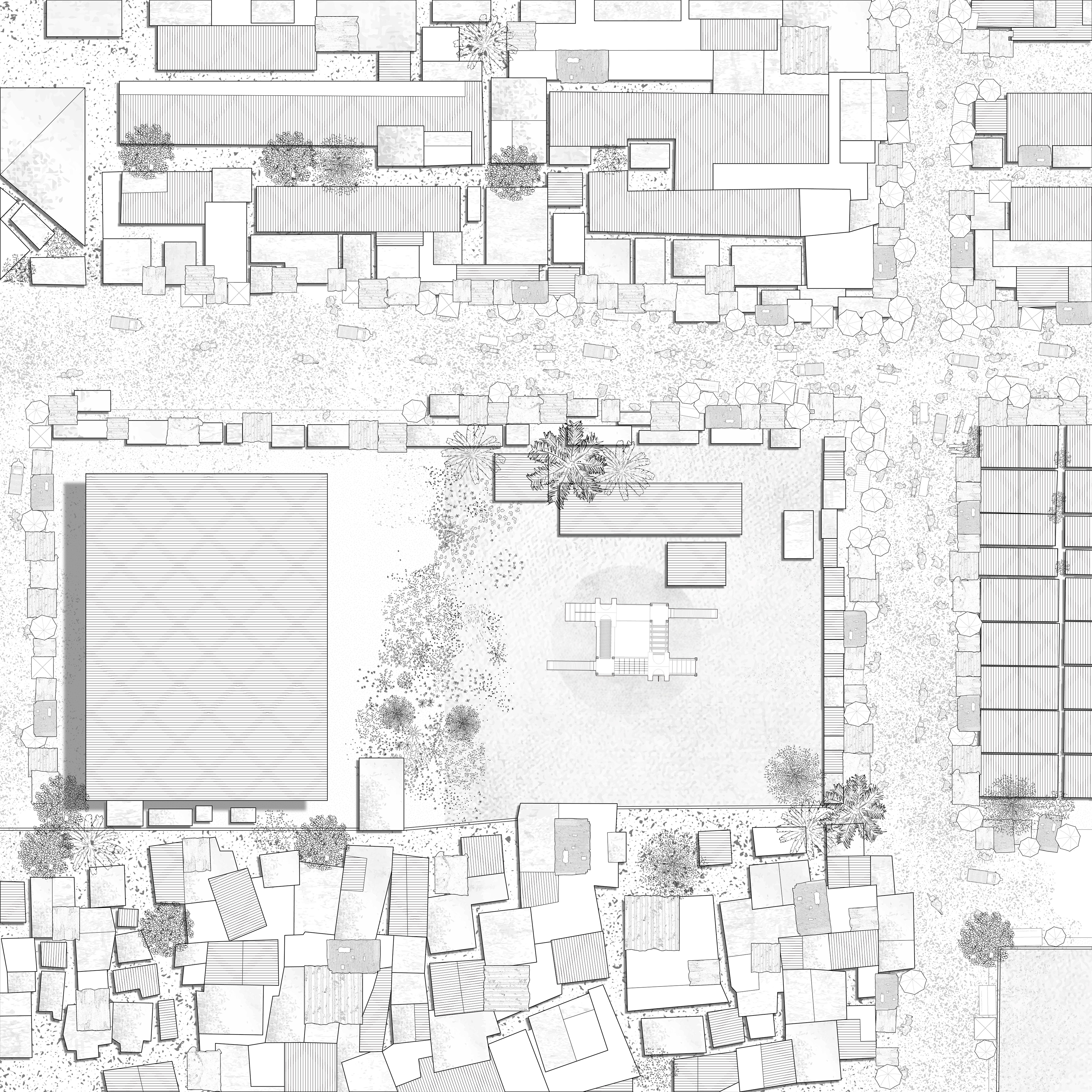
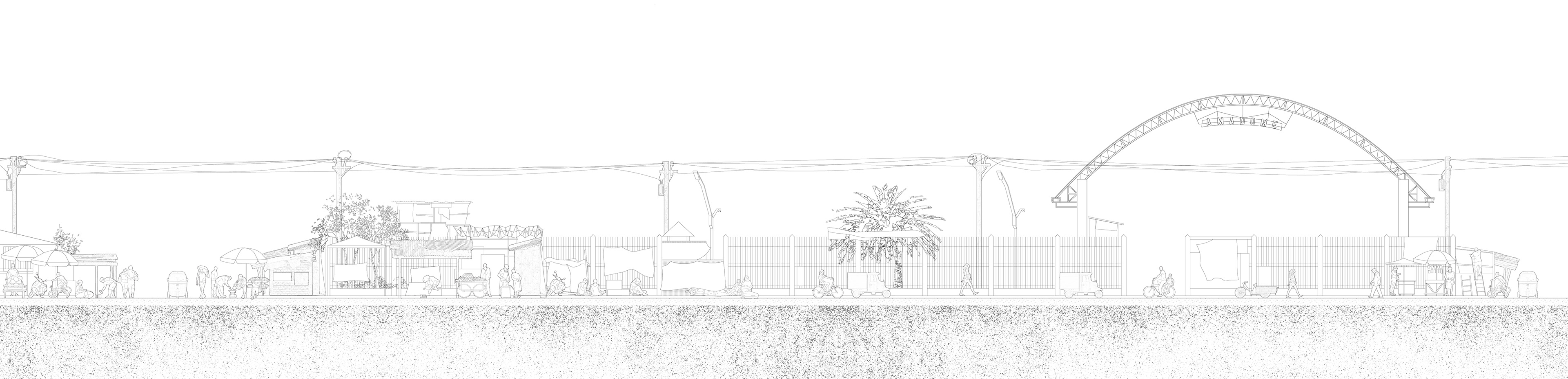
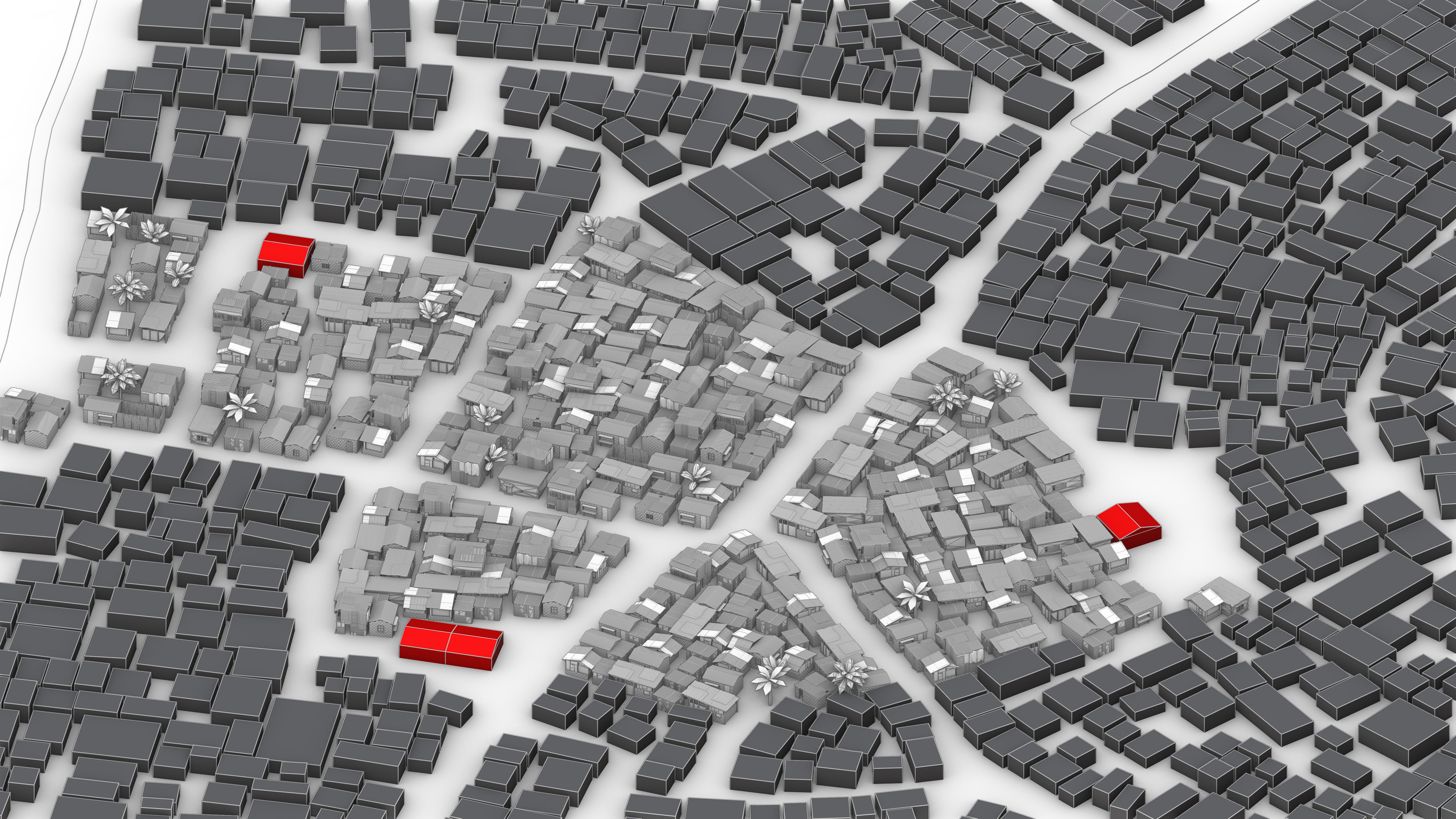
The distinction within the BASECO compound is evident through its cultural, socioeconomic, and spatial organization. The western and southern areas are particularly vulnerable to flooding due to substandard construction and high population density.
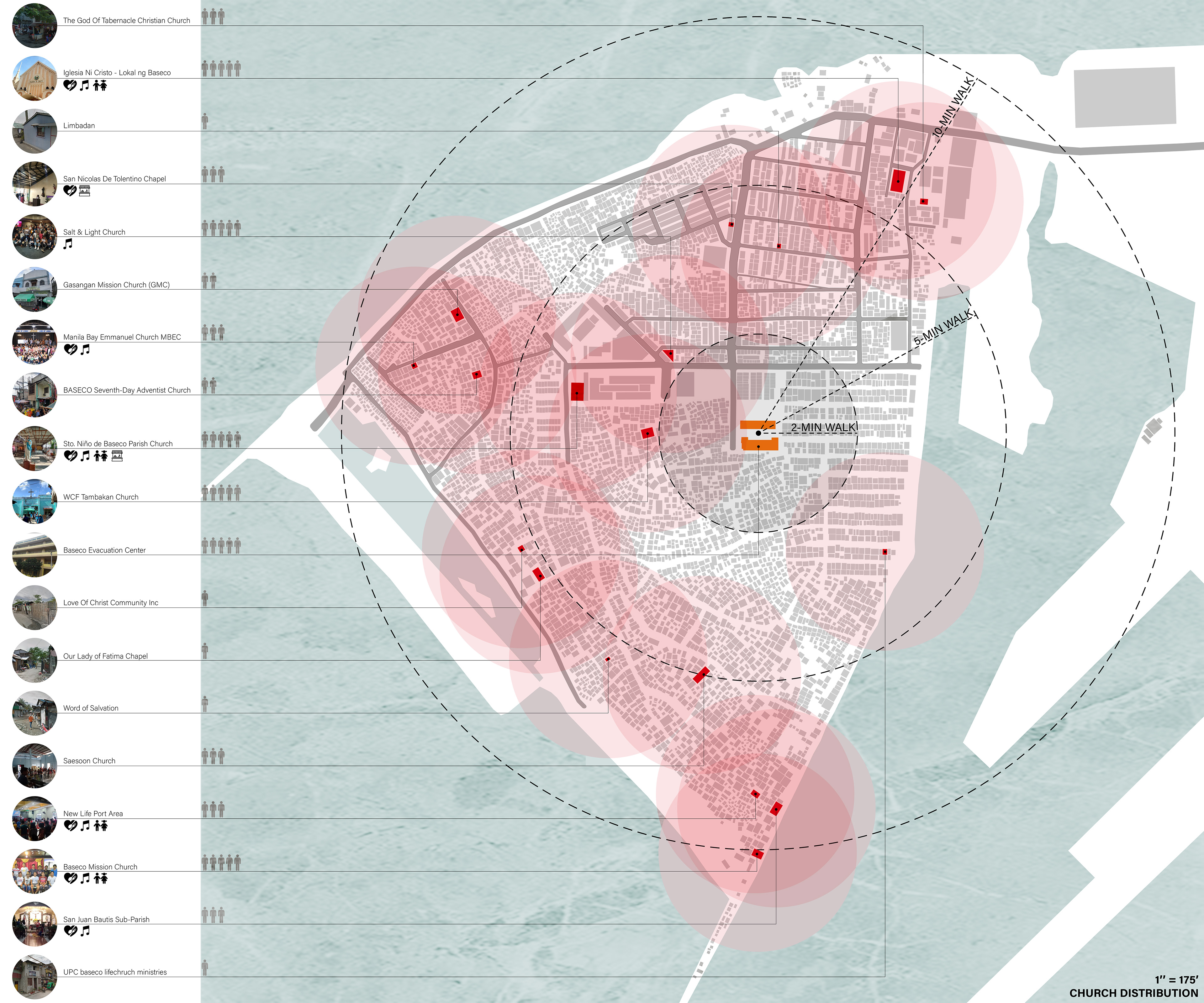
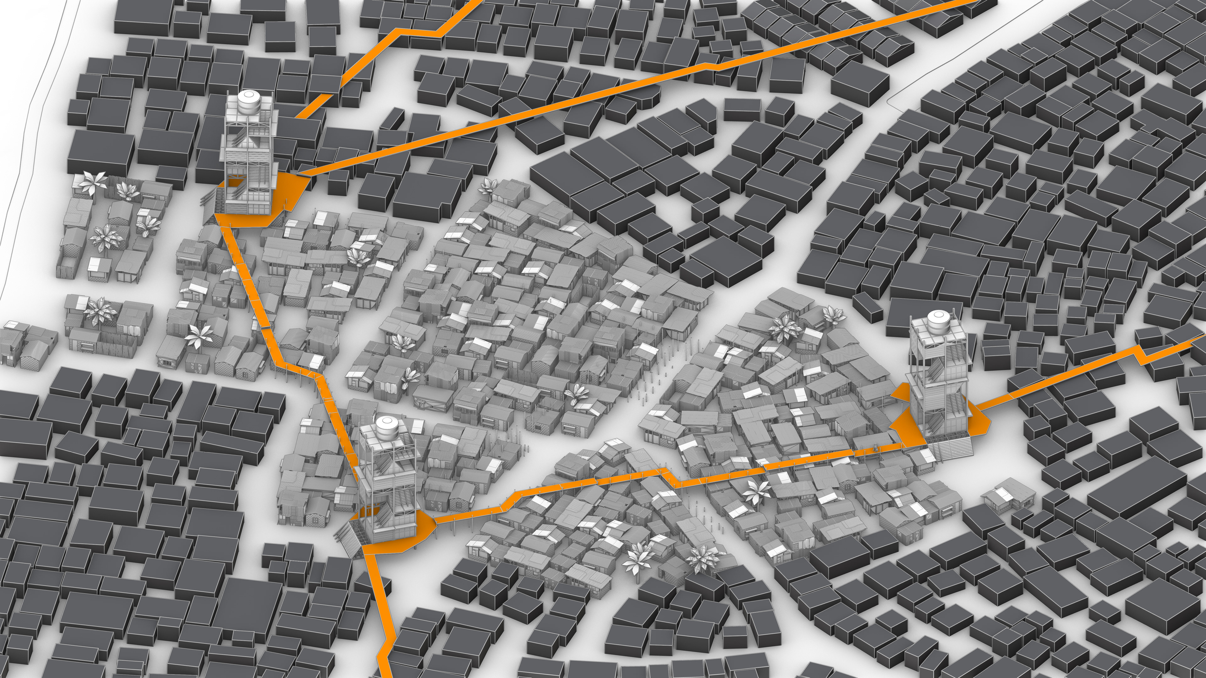
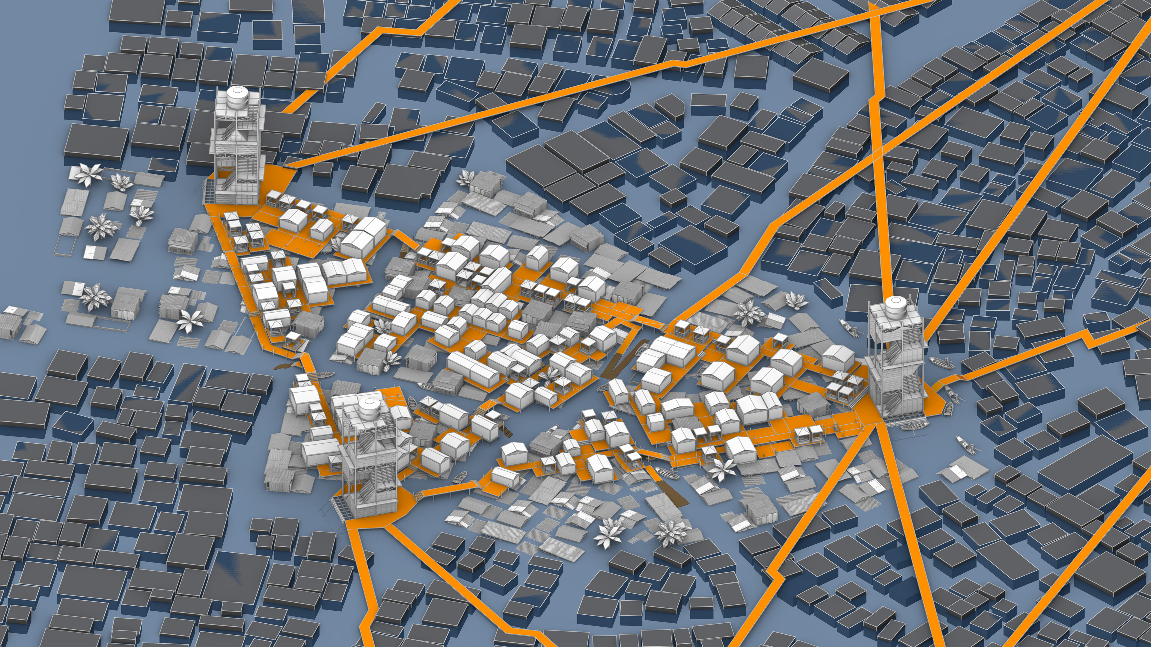
By combining geospatial and demographic analysis of the site, church becomes the location for the towers due to the fact that the majority of residents are religious, and the number and distribution of churches can cover the entire site. Moreover, the church is a central gathering place that people are familiar with on a daily basis.
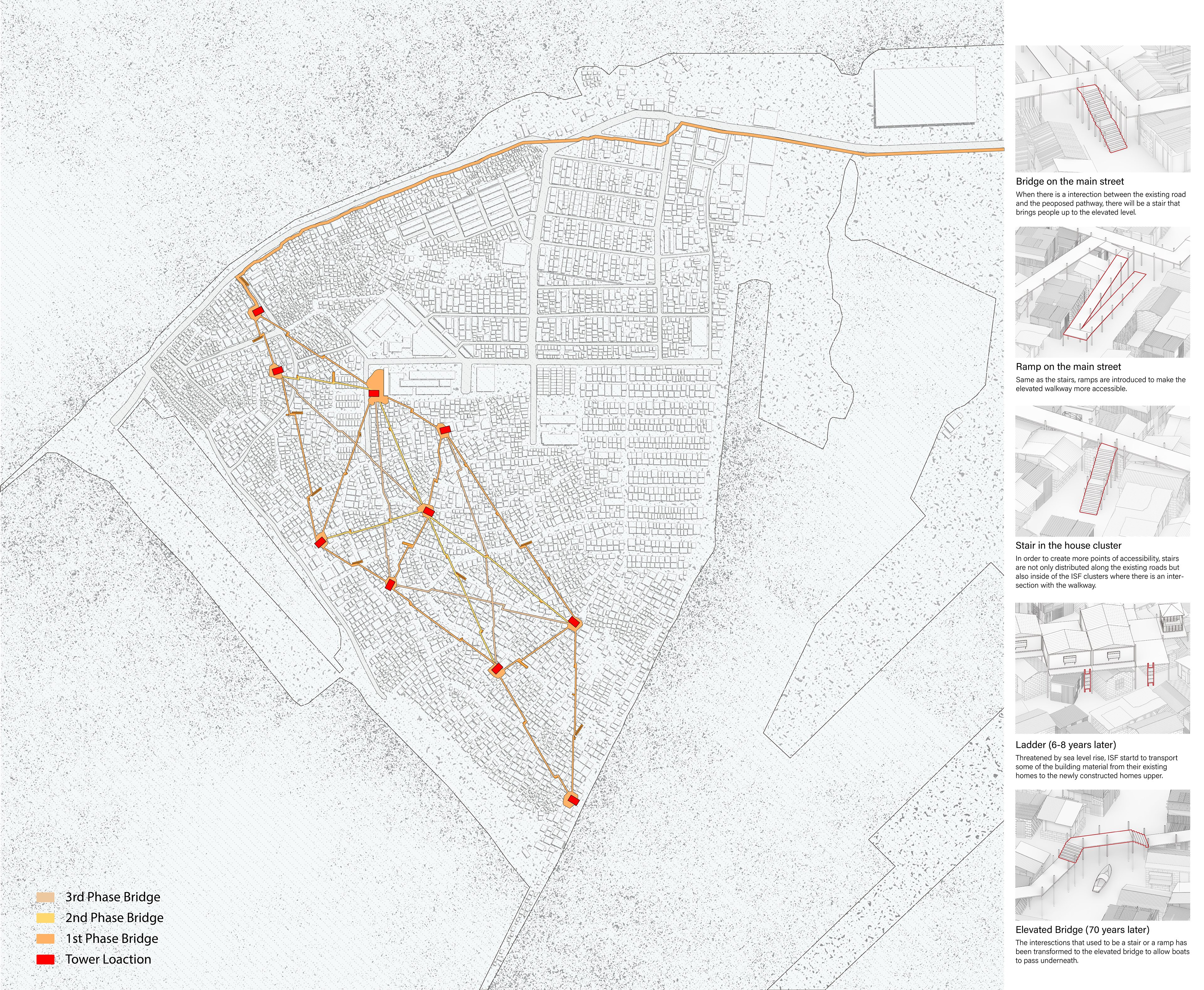
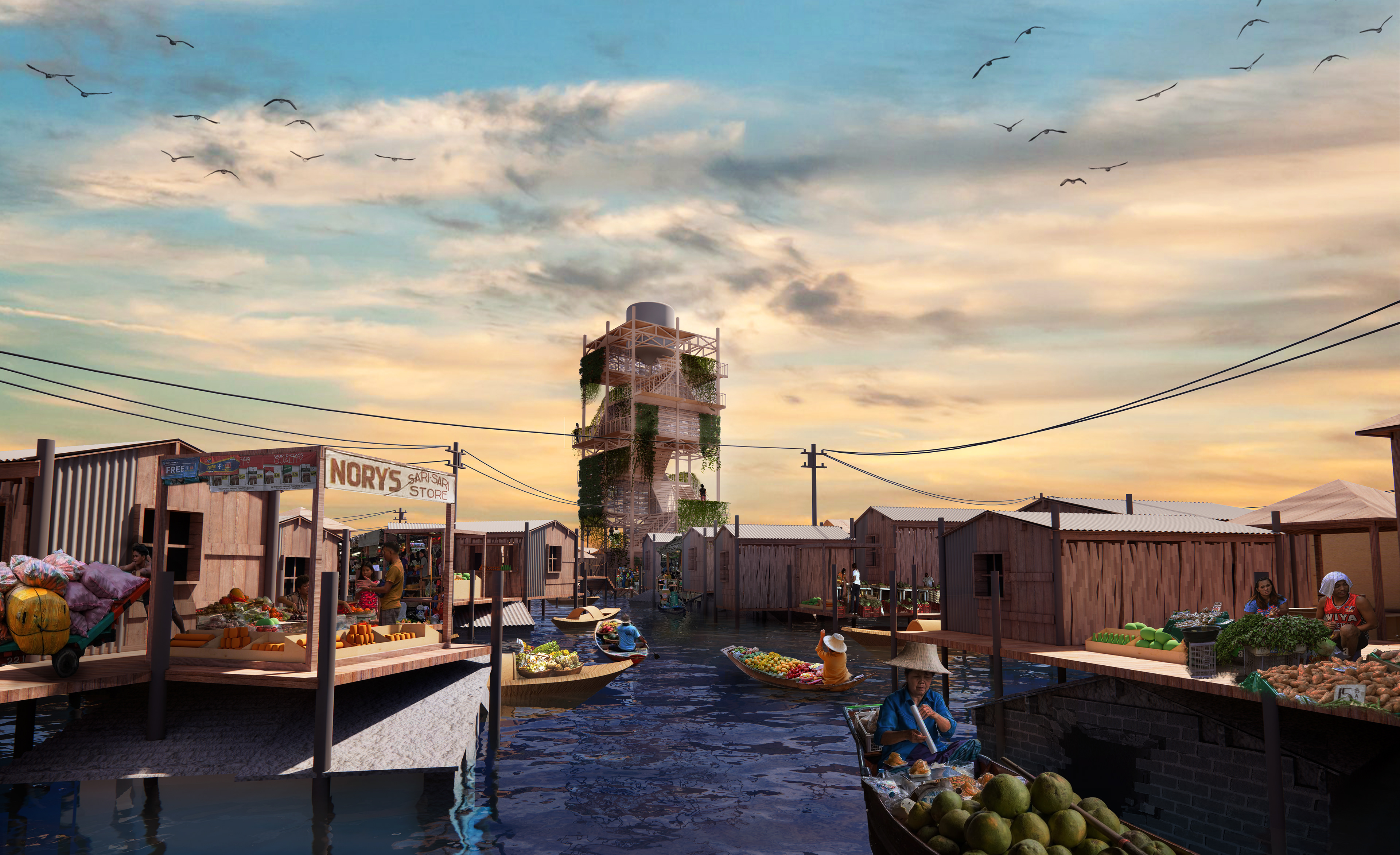
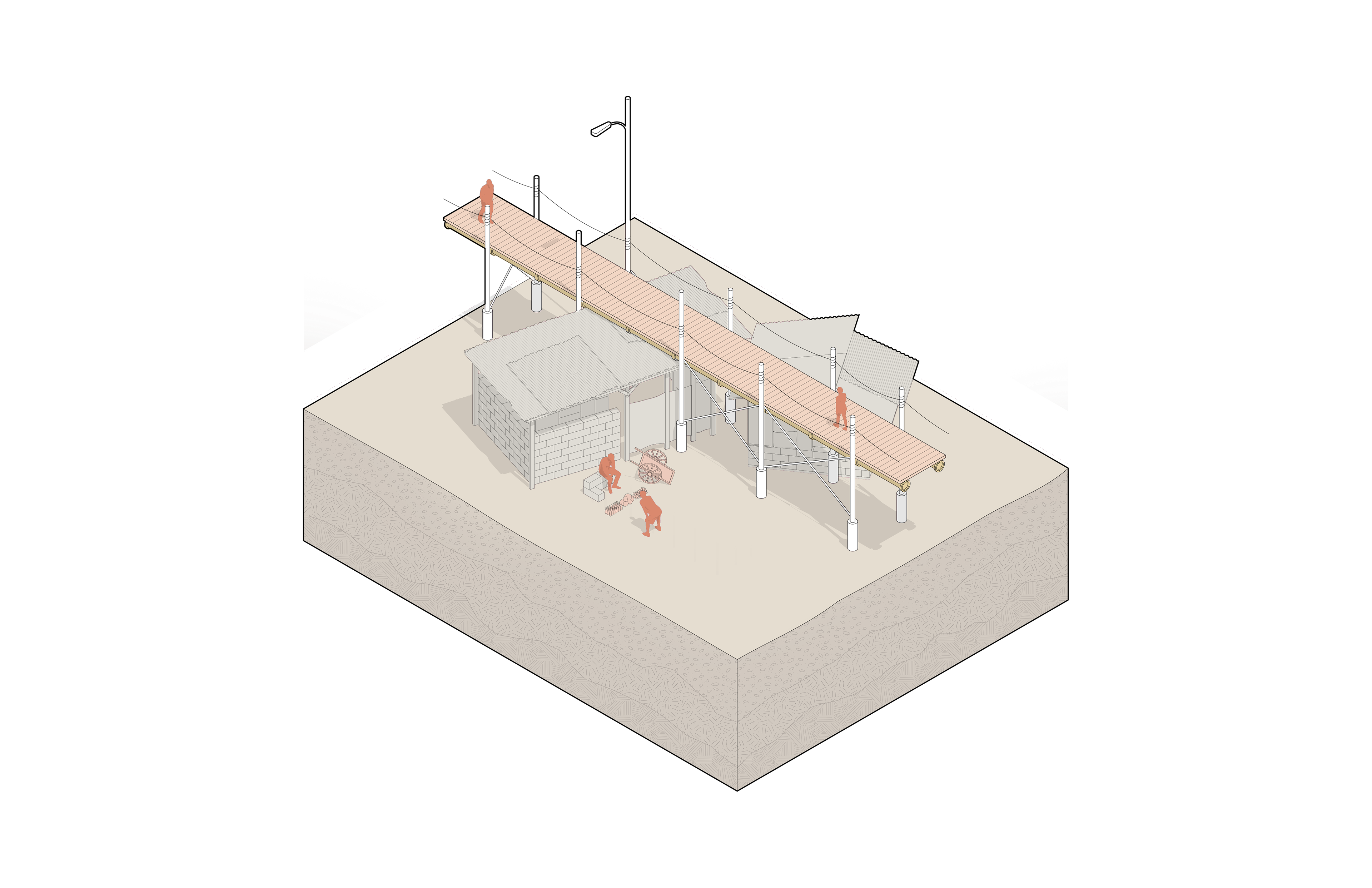
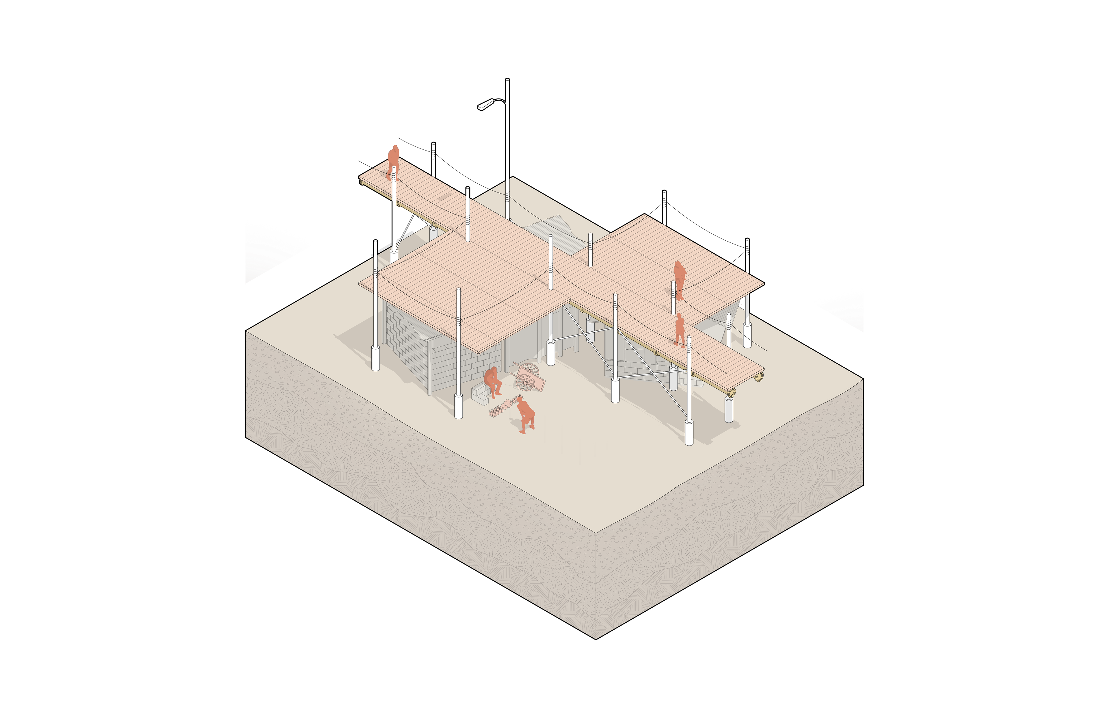
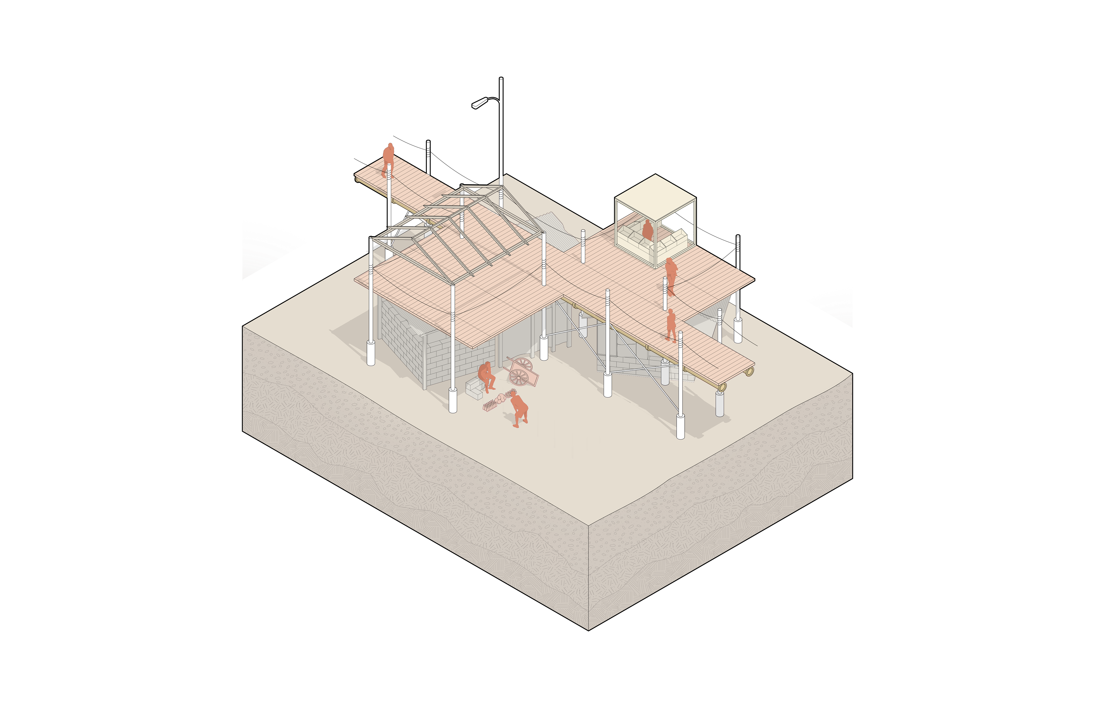
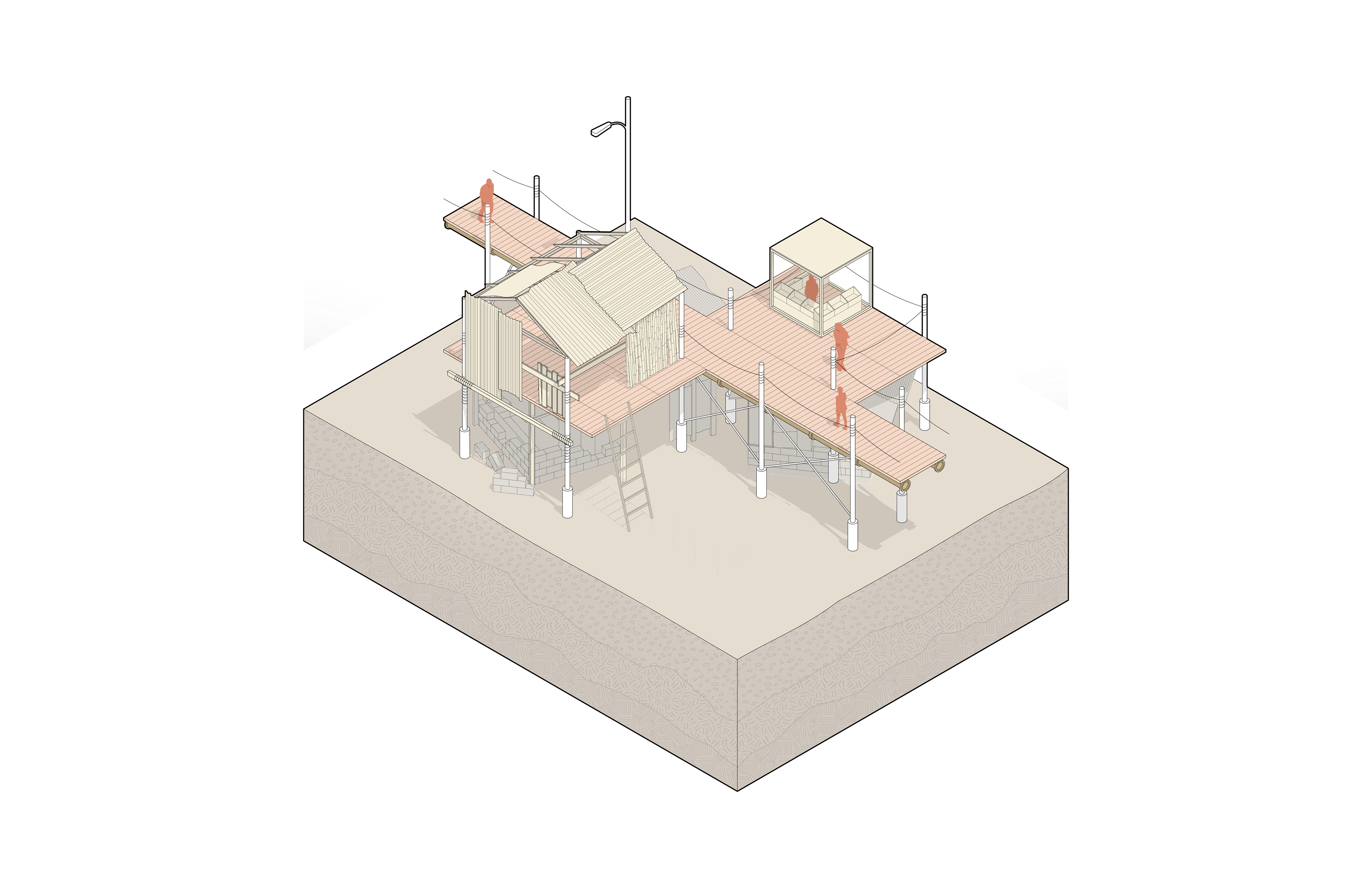
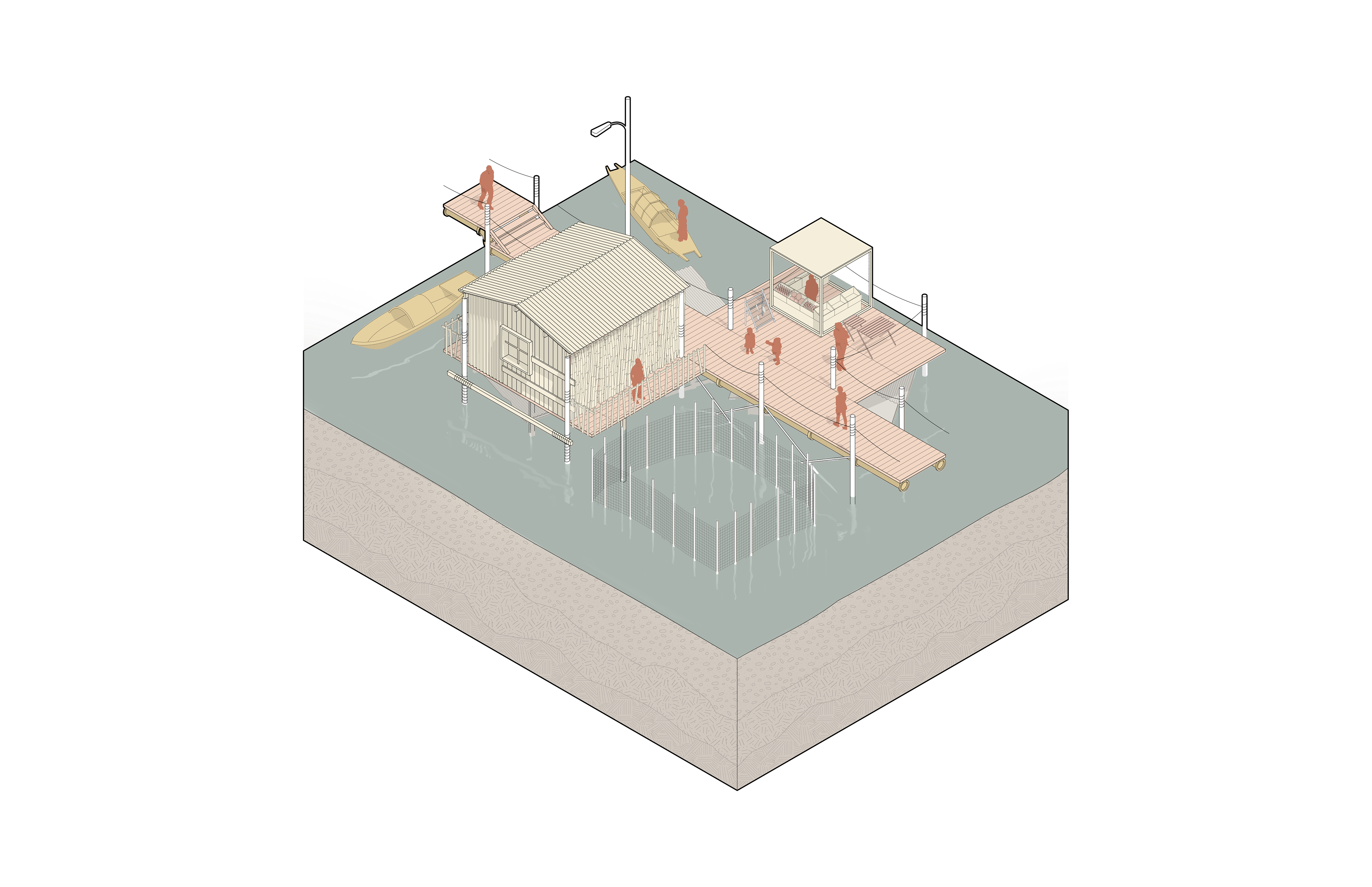
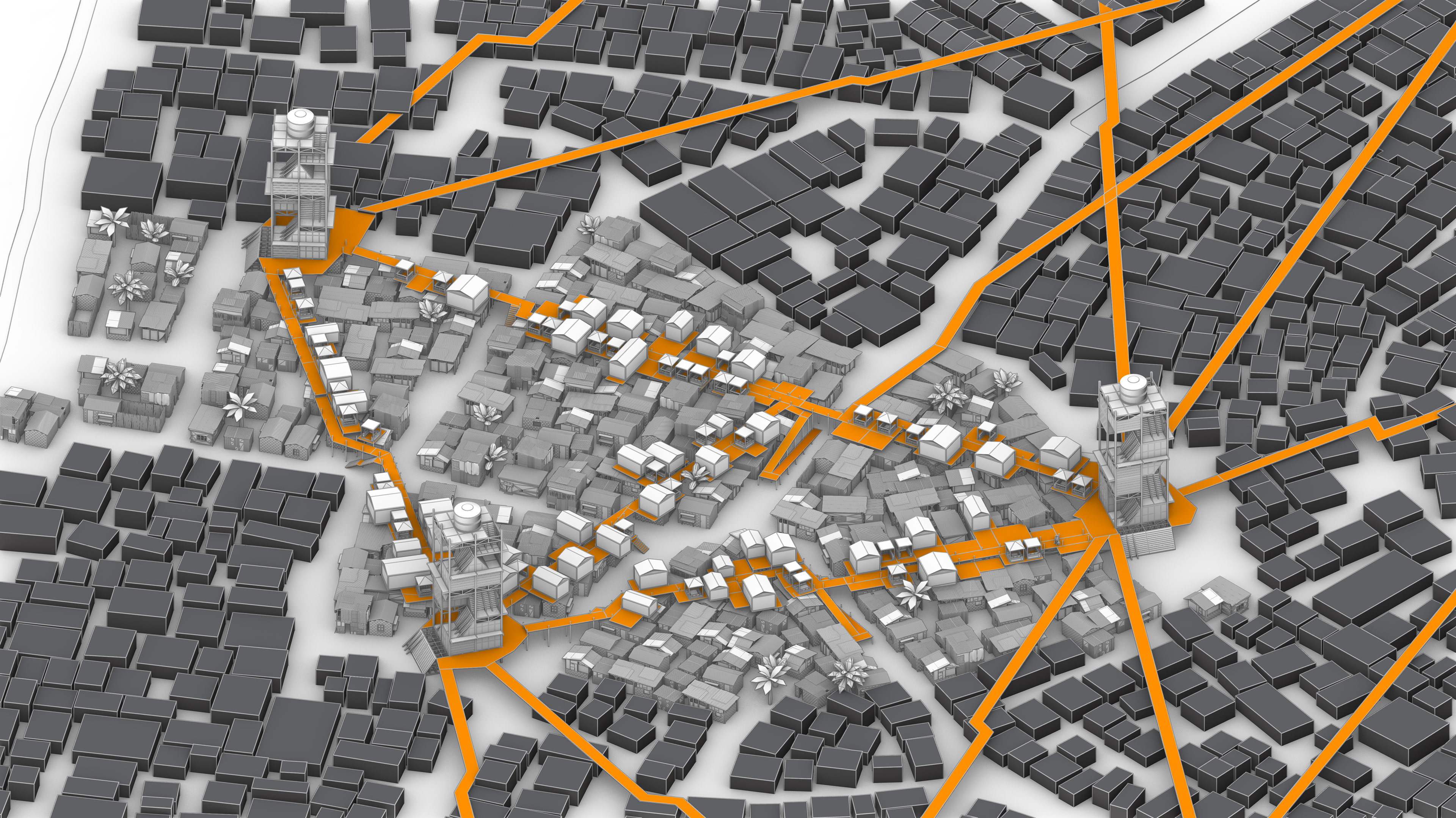
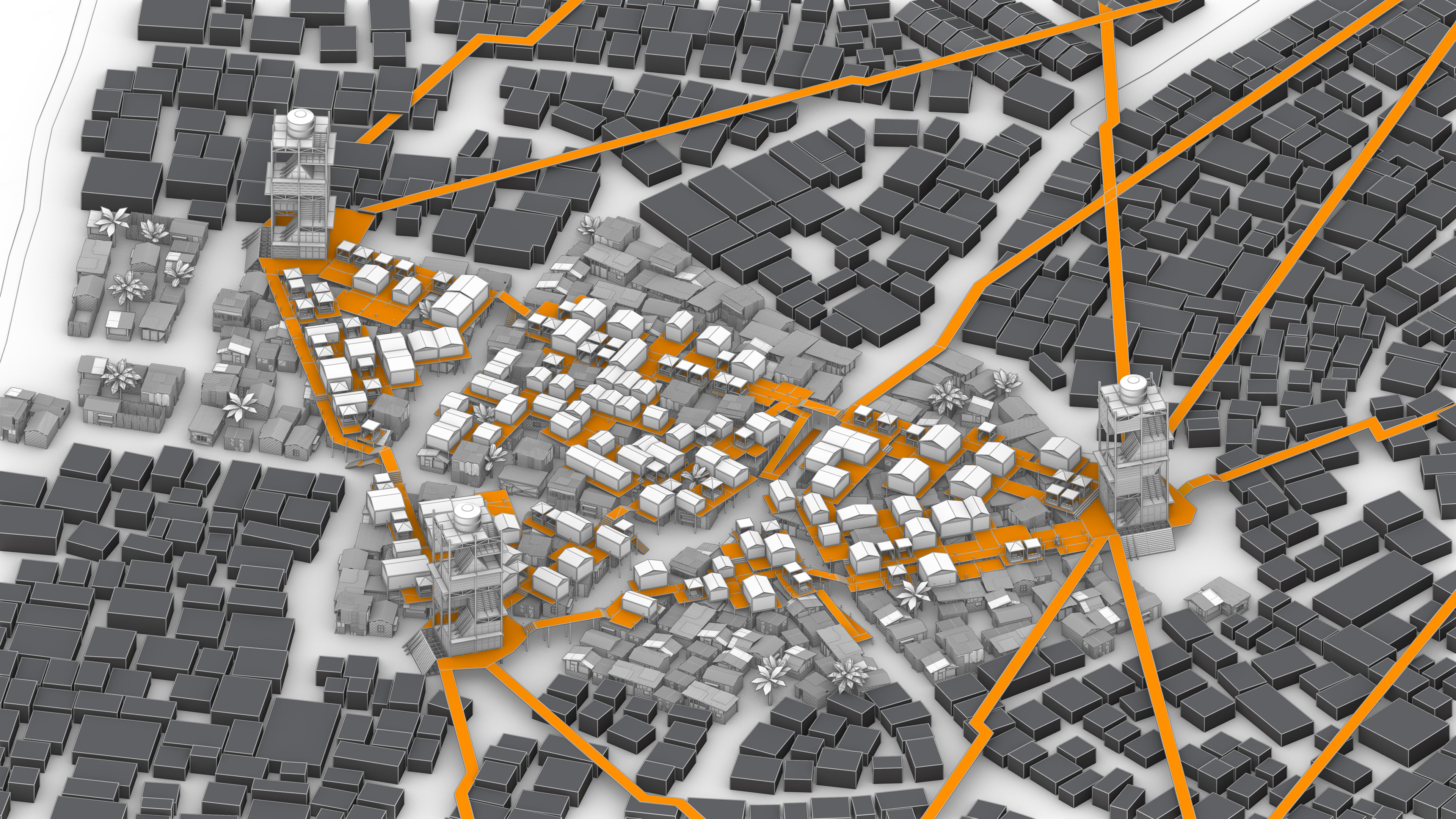
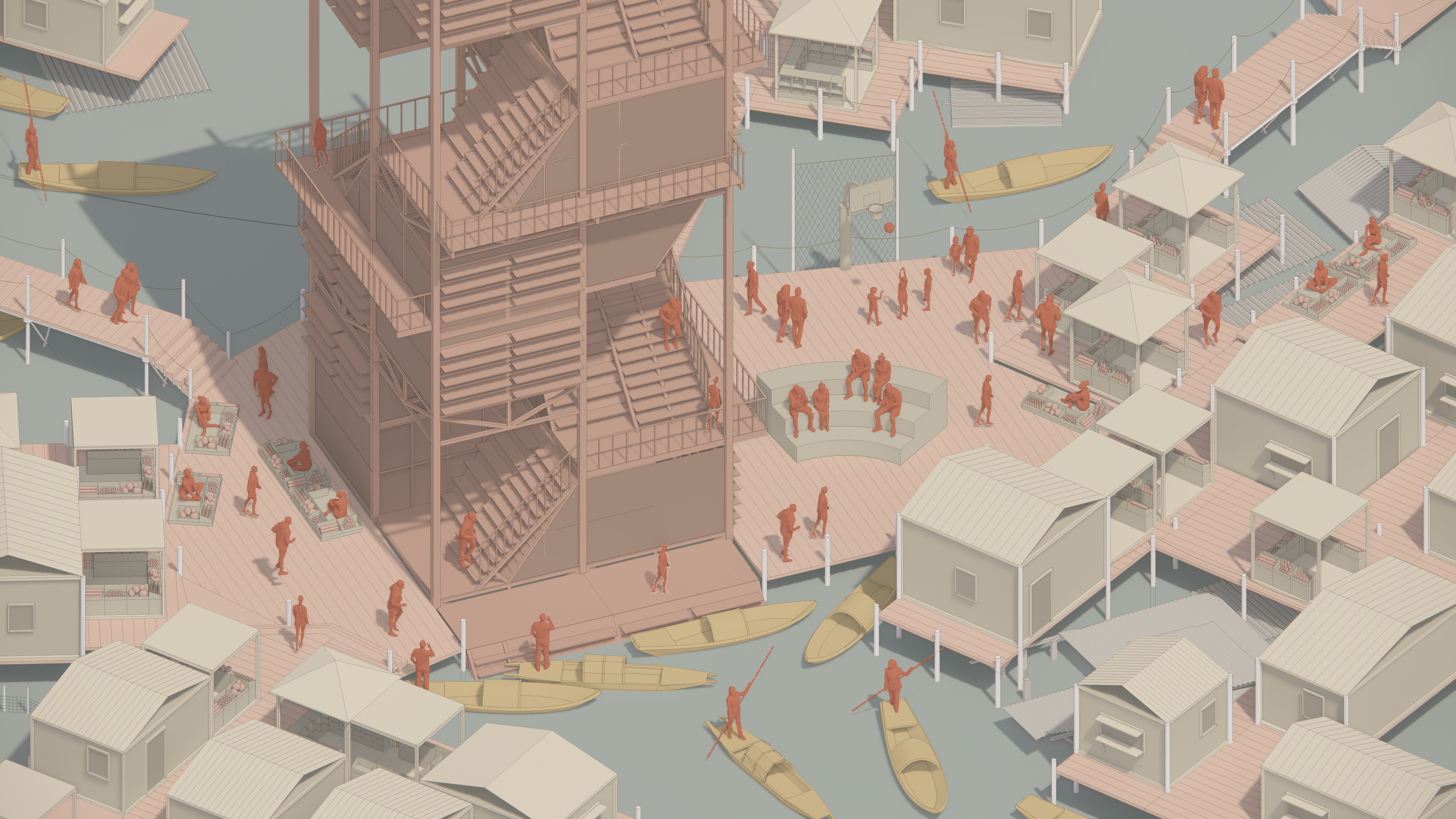
Our proposed strategy includes a mat-building approach and introducing an elevated walkway system that spans the targeted zone and connects from church to church. The goal is to gradually relocate current ground activities and daily life cycles to the elevated bridges. This provides a faster and safer route for escape during floods and offers an improved living environment for local communities. The elevated bridges will accommodate new versions of existing programs, such as a stall market, and introduce essential infrastructure like clean water pipes, which are currently lacking and urgently needed.
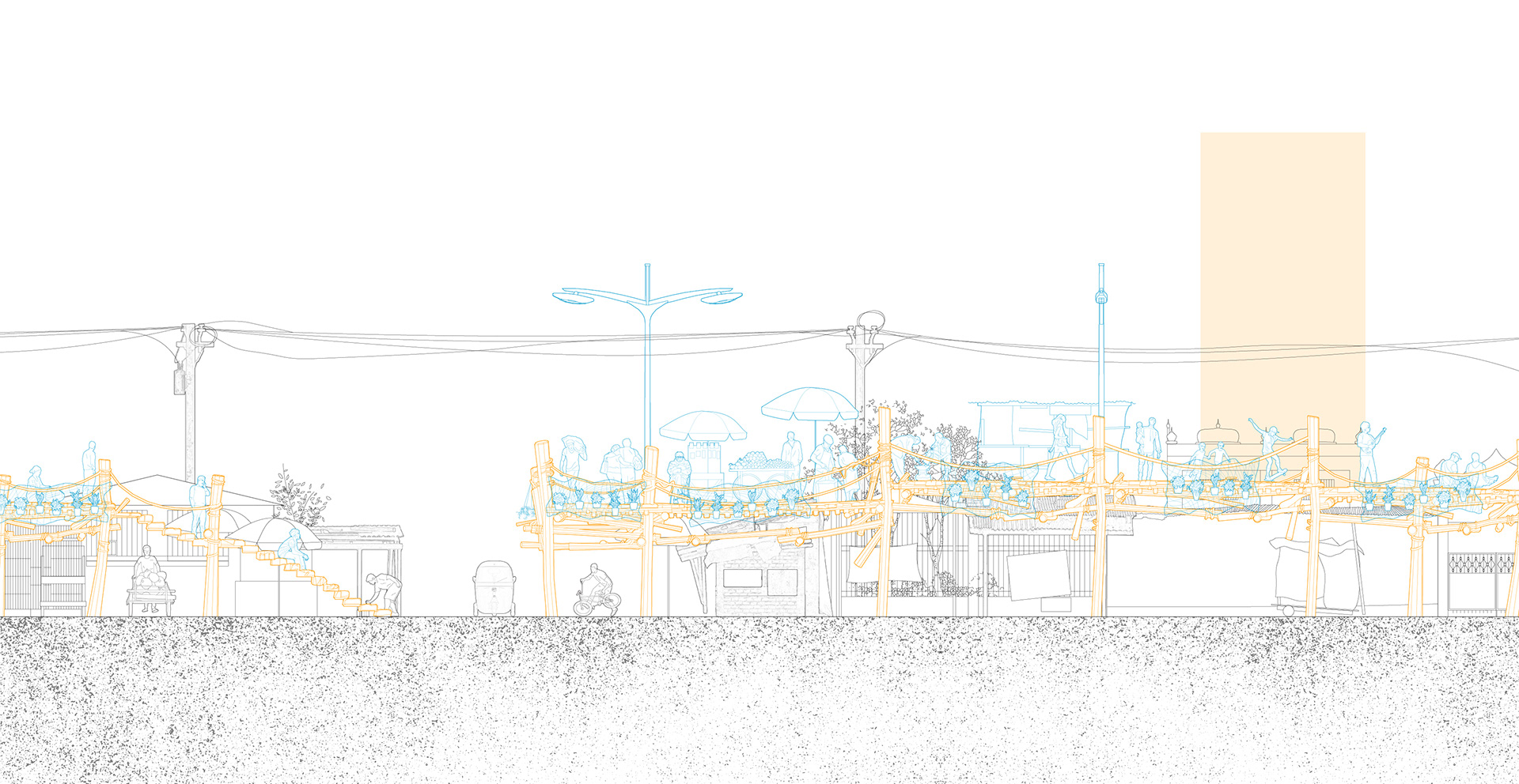
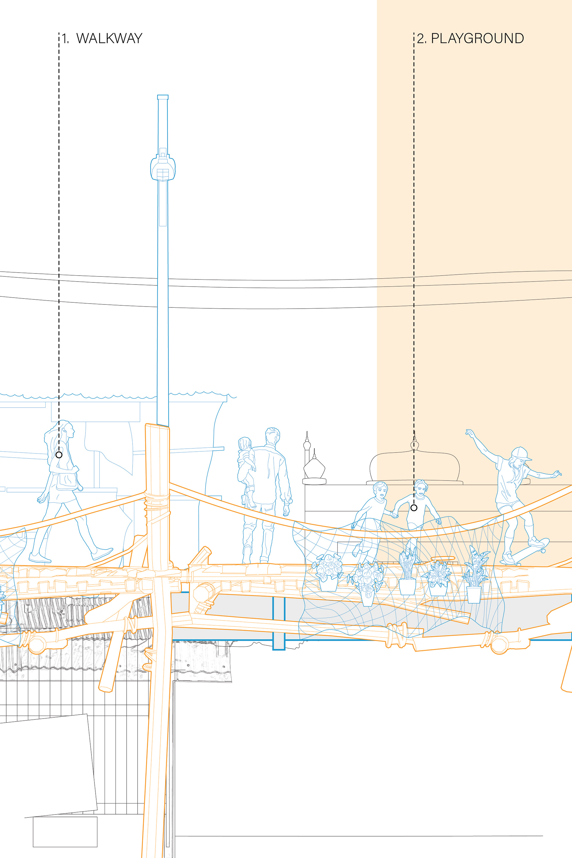
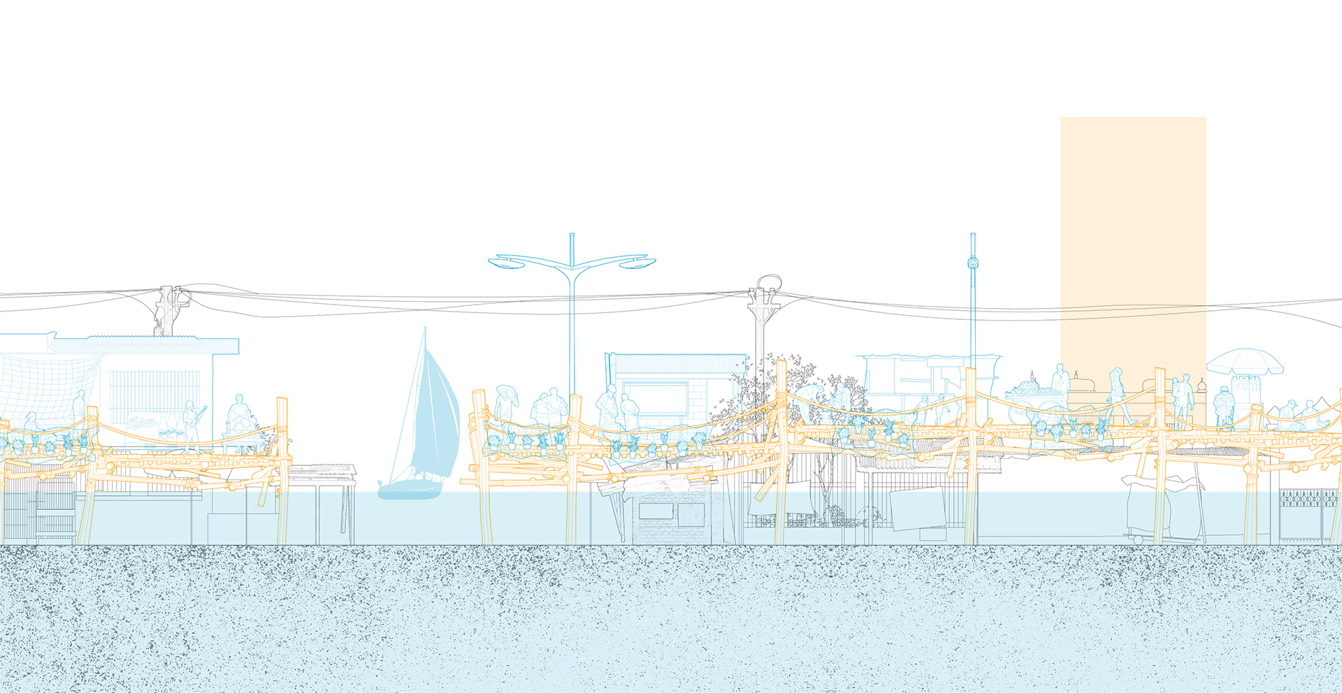
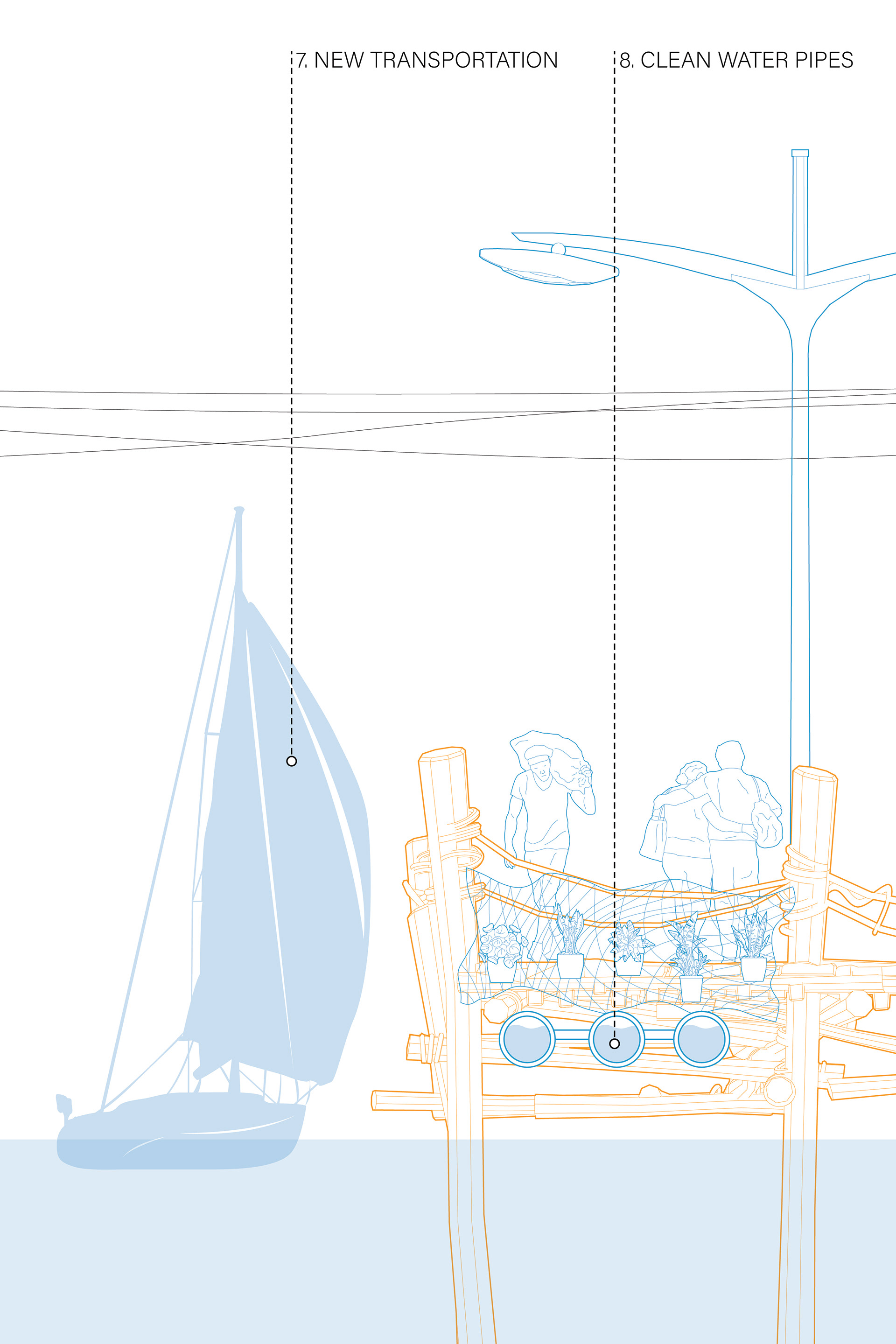
The bridges act not only as a walkway but also provide platforms for second-floor buildings, retail, and recreation spaces. The daily activities are slowly transitioned from the ground to the upper level. And eventually, when the first floor is submerged in water, the void space could be used for boat transportation and fish farming pockets.
Current

2-Year
3-Year

5-Year

6-Year
8-Year

15-Year
20-Year
70-Year
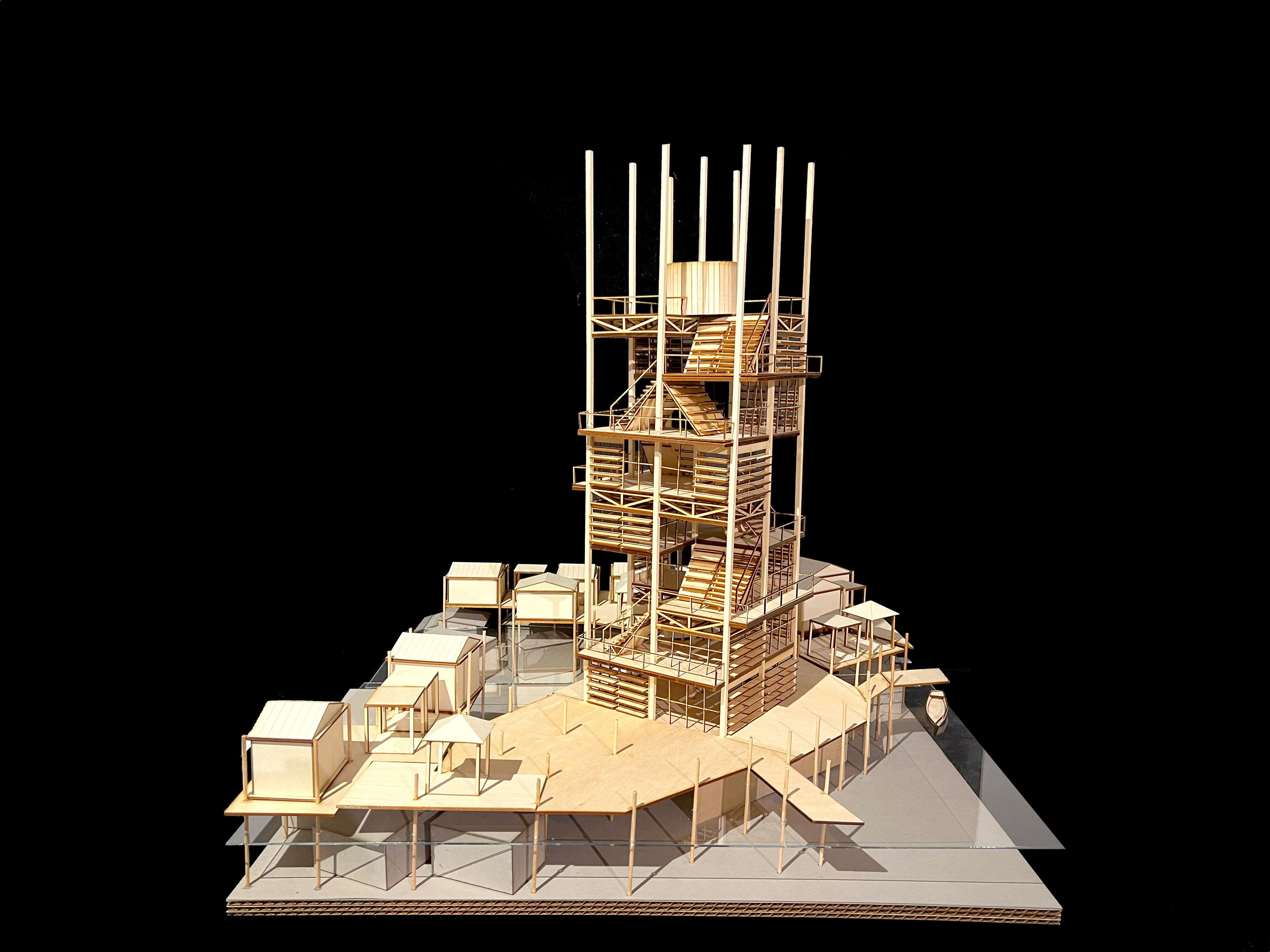
Water as the clue curates our design narratives. The tower is designed not only as a beacon for temporary shelter but also to symbolize a life cycle, where the water tank is placed on the top not only due to physical gravity but also as a metaphor for a life source. The flood water below could cause insecurity. And all other programs in between are following a sequence of life including the church for baptisms, daycare for children, and communal kitchen for adults.


In summary, this is a project that tackles multiple scales, from reforming the urban landscape and planning infrastructure, to rebuilding the church to the tower, and to the scale of a single house. We strive to seek a balance between top-down and bottom-up approaches, between governance and autonomy. We deeply know that interference can impact the lives of locals in significant ways; therefore, we design to provide for their basic needs while respecting their culture, religion, and habits to avoid gentrification.

Water plays a crucial role in the lives of locals, and we use it to create opportunities such as fish farming and a new market economy while also managing its threats such as floods and sea-level rise. The water tank above symbolizes a life source, while the water below poses a life threat, and our goal is to help people thrive in between.